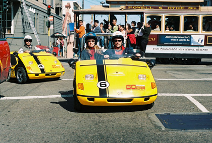
The press kit says: “GoCAR is the world’s first computer guided storytelling car. The clever talking car navigates for you, but that’s not all. As you drive, it points out the sights and tells you the stories that bring San Francisco to life.”
(Video: GoCar Franchise Services, Inc., via Youtube.com)
A three-wheeler moped with navigation system and GPS-triggered audio guidance. The “storytelling car” seems to be fun. Started 2004 GoCars are meanwhile available at San Francisco, San Diego and Miami, franchisers for further cities are searched for. At a first glance unexpected, but at the second it is reasonable – GoCar is offering location-based advertisement:
“The GoCar becomes a trusted companion in an unfamiliar place; telling stories, pointing out landmarks, assisting our customers explore and enjoy a city adventure. Which is why we call the GoCar the Local on wheels. The GoCar can vocalize your business right as the GoCar drives by your premises delivering its unqiue personality. Not only do the pasengers get notified of your unique business proposition, but also bystanders who are naturally looking at the car as it talks about your premises.”
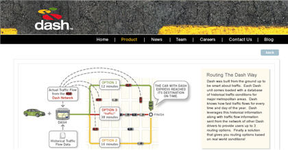
A video clip from the presentation on the personal navigation system from Dash at the Web 2.0 summit in October 2007 at San Francisco – via Glenn Letham’s AnyGeo Blog:
A geo community for web and phone users, where everybody can upload geolocated photos, audios, videos, points of interest. About GyPSii:
“GyPSii is the consumer application for mobile, web & Internet connected devices.GyPSii allows users to share their real life experiences in the virtual world using mobile devices and the web. It is a social networking, search & location based suite of integrated mobile and web applications – for users to share, view & upload pictures, video, text and POI (points of interest) with a Geo-location – place and track each other in their select communities. Find people and places, points of interest, map and navigate to them all.
A record of a Life History of Events in Full Context (Video & audio clips, location(s), photos, text, shared experiences & people, etc.)
A seamless mobile & web experience built on the convergence of locations based services, social networking, mobile & web 2.0 technologies, agnostic access across devices and networks.”
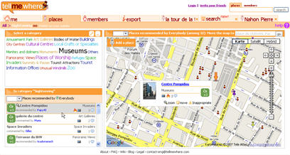
GPS Business News published an interview with Interview with Pierre-Antoine Durgeat, co-founder, DisMoiOu (TellMeWhere) a French LBS community web site. The web site is free, the business model is to generate revenues from advertisement. GBN asked the following question on the product concept of the “user generated point of interest community”: What is the driver behind DisMoiOu.fr/TellMeWhere.com?
“Durgeat: Users are in demand of qualified and up to date local information. Internet allows for a great wealth of information to be searched and looked at. Unfortunately this information is now very close to paper information. It is static and lacks interactivity. Web 2.0 applications linked to LBS solutions allow for such information to be up to date and shared at a minimal cost. For example, databases are up to date on hotels and parking lots, not on Roman churches or skate board parks. We have therefore created the technology for points of interest to be known and promoted to end users in need of such vertical information. We expect to allow for example a handicapped person to know where handicapped parking spaces are available in Paris. The community caters for the good of each user. The founders’ vision is ultimately to create an exhaustive up to date, user generated points of interest database.”
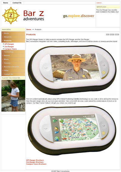
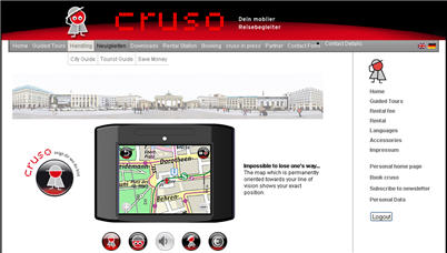
Here comes “a location based self-guided touring system” from BarZ Adventures. It is an offline GPS multimedia guide system for zoos, parks and historic sites. It shows visitors their position on a map and automatically plays videos, audios, stills or texts at the right place of a specific site. The GPS Ranger is comparable with the cruso and the nodeexplorer – although the latter is a connected device and offers a content management system.
Ed Moltzen attracted my attention on ChannelWeb, hinting at the current Dash activities. Ed also pointed at the two sources quoted below:
“The device is noteworthy because, once deployed, it’s said to do a bunch of things all at once. It’s a GPS navigation device that also integrates WiFi, services from Yahoo, continually updated traffic information and two-way communication.”
“I’ve been on the beta program for Dash Networks who is nearing commercialization of a GPS nav device with a built-in GPRS radio as well as WiFi that enables updated traffic information and Yahoo! Local content while on the go. The Yahoo! Local is pretty good and provides the all-important personalized content related to my location, such as where is the nearest Starbucks or pizza joint. Apart from the obvious interest in the combo of tailored Internet content and location, the as-yet unrealized potential is with the WiFi interface. Currently it’s doing firmware updates when parked in your garage at home or brought in the house. But if these devices or a common protocol for peering among such devices (Standards Bodies, how ‘bout it?) grow in numbers on the streets and highways, whether they be mobile in-vehicle or fixed roadside can be the REAL killer apps for these networks of devices!”
Erick Schonfeld on the mashup concept in TechCrunch:
Owners will be able to manage which mashups they receive through Dash’s Website. There, they will be able to drag feeds from sites like Platial, where they can create a Google Map of dog runs in San Francisco or yoga schools in LA. Link it to Zillow, and you will be able to get data on houses as you are driving around the neighborhood. Create a feed at Upcoming.org about all the rock concerts in your city or one of open houses from Craigslist, and you will be able to get the info in your car, along with how far away each place is. You will also be able to do a Yahoo Local search on the device for restaurants and it will return nearby results with ratings.
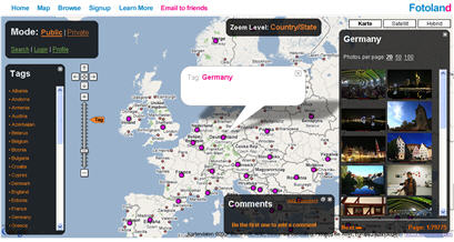
Another mashup by Taher Baderkhan. Fotoland.us is a community concept that “brings you pictures from all over the world by combining technologies from Flickr and Google Maps using the power of tags. It is the best and fastest way to explore pictures of other cities, locations and cultures. Fotoland is a user collaborative effort that grows with your participation.” It is the same approach as loc.alize.us
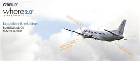
“Where 2.0 brings together the people, projects, and issues building the new technological foundations and creating value in the location industry. Join with other developers, technologists, CTOs, researchers, geographers, academics, business developers, and entrepreneurs to debate and discuss what’s viable now, and what’s lurking just below the radar. “
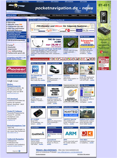
The leading German portal for mobile navigation systems. News, tests, more than 90.000 community members and lots of content to subscribe (points of interest, guides, speed camera data etc.). The data can be used with an add-on software for mobile navigation systems.
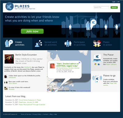
Plazes added the “Where?” to communities. Here is an excerpt from the FAQ, the Question is “Why do you call a Plaze a Plaze and not a location?”
“A Plaze represents much more than just a location. It is the identity that you give to a physical location. So, for instance, a restaurant and an office are both located on “111 MacDougal Street, NYC. In this case you have one location, but two Plazes. (Hey, it’s the context that counts)
Every Plaze has its own permalinkable page that consists of pictures, comments, a map, and a list of people who have visited the Plaze.”
The “first mobile city guide for pedestrians” is now available at some Munich hotels. Cruso started the gps gadget rental service at Berlin, where the inventor “Dreifach Einfach” is located.
Nick Trend’s homage to the world of audio guides is an inspiring look at some examples of current audio experiences especially at museums and galleries, and he states why he likes audio guides:
“If you want more detailed explanations, you have to rely on human guides (very variable), general travel guides (very sketchy on most cultural sites) or the museum’s or site’s own guidebook (often awkward to read while you tour).
The best solution is to hire an audio guide, and it always surprises me how few visitors use them.”
“Geotagging, sometimes referred to as Geocoding, is the process of adding geographical identification metadata to various media such as websites, RSS feeds, or images. This data usually consists of latitude and longitude coordinates, though it can also include altitude, bearing and place names.
Geocoding also refers to the process of taking non-coordinate based geographical identifiers, such as a postal address, and assigning geographic coordinates to them (or vice versa).
Geotagging can help users find a wide variety of location-specific information. For instance, one can find images taken near a given location by entering latitude and longitude coordinates into a Geotagging-enabled image search engine. Geotagging-enabled information services can also potentially be used to find location-based news, websites, or other resources.”
As “OTA” expects 2008 to become “the year of mobile location” one of the questions was “What kinds of new, unique applications is GPS enabling on mobile devices that we didn’t see on the desktop?”
Darren’s answer:
“There are lots of other applications out there where knowing your location provides the context for new types of information. Three of the coolest new applications I can think of come from the finalists of the “maps in Apps” contest Tele Atlas held recently as part of its “LBS Innovators Series.” The first is Slifter, which allows shoppers to search local store inventory for products from their handsets. Users can search for more than 85 million products available from 30,000 retail locations, view product information, images and store locations and maps. They can also share their finds with friends or save them to a mobile shopping list.
Hollywood USA is a tour guide features movie locations across the country with added GPS deployment on the uLocate — WHERE platform. Each site includes location photo and address, scene and plot description, stars, director and DVD cover image.
KnowledgeWhere PhoneTag Elite incorporates location-based mapping and messaging technology to create a hi-tech game of hide and seek. Players can play with anyone across the United States by participating in existing games, creating private games with friends, or participating in cash tournaments. Objective of game play is to capture your target while evading capture.
At a conceptual level, we think the future of LBS is all about extending the definition of an “address” beyond a house or an apartment — “where I live” — to include any temporary physical location — “where I am right now.”
In addition to the applications I just described, others will capitalize on this by enabling the on-demand delivery of goods and services — a pizza to a couple sitting on a blanket in a park, or a replacement windshield to a car in a specific parking space in a giant mall parking lot, for example.”
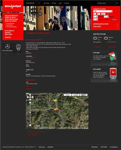
The tourism board Kitzbühel, Austria, has integrated a “geotargeting feature” into their website www.kitzbuehel.com, reports Tirol.com. The “geographical search engine” is using Google maps to enhance the search experience of users and to foster online bookings especially for smaller hotels, B&B with lower marketing budget.
The Service was provided by elements.at, Salzburg, Austria.


 Posted by Andreas H. Bock
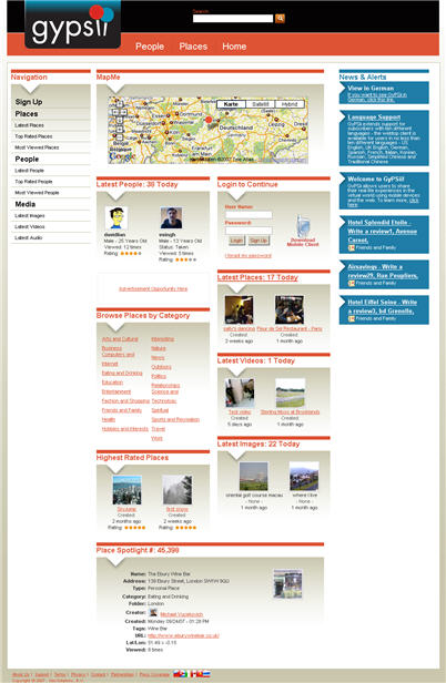


You must be logged in to post a comment.